Category · 189 posts
Geography
Deep dives into how to read the planet — satellite-imagery cues, country-by-country signatures, climate and agricultural patterns, and the geography questions players actually ask.

What Is a Rift Valley? How the Earth's Crust Splits Apart
Rift valleys form where the planet is slowly tearing itself apart. Here is how they form, where to find them, and why one of them is splitting Africa in two.
Read more
What Is a Wetland? Marshes, Swamps, and Bogs Explained
Wetlands are neither fully land nor fully water, and they are some of the most valuable ecosystems on the planet. Here is how marshes, swamps, and bogs differ.
Read more
The Largest Seas in the World, Ranked
Seas are the smaller, partly enclosed cousins of the oceans — but some are enormous. Here are the largest seas on Earth, from the Philippine Sea on down.
Read more
Bay vs. Gulf vs. Cove vs. Sound: Coastal Waters Explained
Bays, gulfs, coves, and sounds all describe water reaching into the land — but the names follow custom more than rules. Here is how to tell them apart.
Read more
How to Spot a Wildfire Burn Scar From Satellite Imagery
After a wildfire passes, it leaves a mark visible from orbit for months. Here is how to recognise a burn scar in satellite imagery and read how severe it was.
Read more
What Is a Savanna? The Tropical Grassland Biome Explained
Savannas are vast tropical grasslands dotted with scattered trees, ruled by a rhythm of wet and dry seasons. Here is what makes this biome work.
Read more
What Is a Sand Dune? How Dunes Form and Why They Move
Sand dunes are some of the most recognisable shapes on Earth from above. Here is how wind builds them, why they have a gentle and a steep side, and how they slowly march across the land.
Read more
What Is a Lagoon? How Coastal Lagoons Form Behind the Shore
Lagoons are calm pools of water cut off from the open sea by a thin barrier. Here is the difference between coastal and coral lagoons, how they form, and how to tell a lagoon from an estuary.
Read more
Mesa vs. Butte vs. Plateau: How Flat-Topped Landforms Form and Differ
Mesas, buttes and plateaus are all flat on top and steep on the sides, but they are not the same thing. Here is how a hard cap of rock builds them, and the simple rule that tells them apart.
Read more
What Is Permafrost? The Frozen Ground Beneath the Far North
Permafrost is ground that stays frozen year after year, locking away ancient carbon under the Arctic. Here is how it forms, where it is found, and why its thaw matters far beyond the poles.
Read more
Why Greenland Looks So Large Beside Africa on a Mercator Map
The comparison changes because Greenland lies much farther from the equator.
Read more
What Is an Enclave? The Strange Geography of Territories Inside Other Countries
Some countries are entirely surrounded by another, and some pieces of land are cut off from their own nation. Here is the difference between enclaves and exclaves, with real examples.
Read more
What Is an Oasis? How Water Reaches the Surface in the Desert
An oasis is a patch of life in the middle of a desert, fed by water rising from underground. Here is how oases form, why they appear where they do, and the role they played in history.
Read more
The Most Visited Countries: The 2024 Arrivals Leaders
France, Spain, the US, Türkiye, and Italy led this dated international-tourism comparison.
Read more
How to Spot Deforestation From Satellite Imagery
Satellites are how the world tracks vanishing forests. Here is how to recognise deforestation from above, from telltale fishbone patterns to the colour shifts that reveal cleared land.
Read more
The Largest Bays and Gulfs in the World, Ranked
From the vast Bay of Bengal to the Gulf of Mexico, here are the biggest bays and gulfs on Earth ranked by area, plus what separates a bay from a gulf in the first place.
Read more
What Is a Glacier? How Glaciers Form and Shape the Land
A glacier is a slow-moving river of ice and one of the most powerful sculptors on Earth. Here is how glaciers form, how they move, and the landscapes they leave behind.
Read more
What Is an Estuary? Where Rivers Meet the Sea
Where a river meets the ocean, fresh and salt water mix to create one of the planet's richest ecosystems. Here is what an estuary is, how estuaries form, and why they matter.
Read more
What Is a Caldera? How the World's Largest Volcanic Craters Form
A caldera is not just a big crater. It is what is left when a volcano collapses into its own emptied magma chamber. Here is how calderas form and where to see the most striking ones.
Read more
Largest Volcanoes in the World, Ranked
Largest means different things for volcanoes: by volume, by footprint, or by caldera. Here are the giants that top each list, from Mauna Loa to the submarine Tamu Massif.
Read more
Largest National Parks in the World, Ranked
The biggest national parks on Earth are larger than entire countries. From the ice of Greenland to the Alaskan wilderness, here are the giants and how to recognize them from above.
Read more
How to Spot a Dam and Reservoir from Satellite Imagery
Dams and reservoirs leave unmistakable fingerprints on the landscape. Learn the tell-tale shapes that reveal them from above, a handy skill for any satellite-guessing game.
Read more
What Is a Karst Landscape? Caves, Sinkholes, and Underground Rivers
Some of the world's strangest scenery, from limestone towers to rivers that vanish underground, is the work of slightly acidic water. Welcome to karst.
Read more
What Is an Isthmus? The Narrow Land Bridges That Shape the Map
An isthmus is a slim neck of land connecting two larger landmasses. Here is how they form, why they have decided wars and trade routes, and where to find the most famous ones.
Read more
What Is a Plateau? How the World’s Great Tablelands Form
A plateau is a raised area of mostly flat land that stands above its surroundings. Here is how the planet builds its tablelands, from the Roof of the World to the canyon-cut highlands of the American West.
Read more
What Is an Atoll? How Coral Rings Form in the Open Ocean
An atoll is a ring-shaped coral reef encircling a lagoon, often the last trace of a sunken volcano. Here is the elegant theory behind them and where to find the most striking examples.
Read more
What Is a Canyon? How Rivers Carve the World’s Deepest Gorges
A canyon is a deep, steep-sided valley cut by running water over vast stretches of time. Here is the recipe behind them and a tour of the deepest gorges on Earth.
Read more
The Largest Peninsulas in the World, Ranked
From Arabia to Scandinavia, the planet’s biggest peninsulas are practically continents in their own right. Here is a ranked tour of the giants of nearly-surrounded land.
Read moreWhat Is the Mollweide Projection? The Map That Keeps Areas Honest
The Mollweide projection squeezes the whole world into a tidy ellipse while keeping every country the right size. Here is how this 200-year-old map works and why scientists still reach for it.
Read more
How to Spot an Airport from Satellite Imagery
Airports are some of the easiest human structures to identify from space. Here is how to read runways, taxiways, and terminals — and use them to figure out where you are.
Read more
The Windiest Places on Earth
From an Antarctic bay where the wind almost never stops to the mountain that held the world wind record for decades, these are the windiest places on the planet — and why the air moves so fiercely there.
Read more
The Newest Countries in the World
The world map is younger than you might think. From South Sudan to the breakup of old federations, here are the newest countries on Earth and the stories of how they came to be.
Read more
Population Density: Comparing Countries Without Hiding the Gaps
A national average measures people per area; it does not describe every neighbourhood.
Read more
What Is a Peninsula?
A peninsula is one of geography's most recognizable landforms — and some of the world's most famous regions are peninsulas without people realizing it. Here is what makes one.
Read more
The Coldest Places on Earth
From the Antarctic plateau to a Siberian village where the ground stays frozen year-round, here are the coldest places on the planet and what makes them so brutally cold.
Read more
What Is an Archipelago?
From Indonesia's seventeen thousand islands to the chain that makes up Hawaii, archipelagos are some of the most striking features on any map. Here is what they are and how they form.
Read more
How to Identify a Country by Its Language and Script
A single road sign can give away a country in seconds, if you know what to look for. Here is a practical guide to reading scripts, alphabets, and telltale letters to pin down a location.
Read more
The Busiest Airports in 2025, by Different Measures
Atlanta led total passengers, Dubai international passengers, and Hong Kong cargo.
Read more
What Is the AuthaGraph Map Projection?
A Japanese designer folded the globe into a tetrahedron and unfolded it into a rectangle, creating one of the most balanced world maps ever made. Here is how the AuthaGraph projection works.
Read more
What Map Projection Does Google Maps Use?
Google Maps relies on Web Mercator, a modern twist on a 16th-century projection. Here is why it was chosen and the trade-off it makes with the size of continents.
Read more
Which Countries Have the Most Time Zones?
France beats Russia and the United States thanks to its scattered overseas territories. Here is the full ranking and the geography behind it.
Read more
The Hottest Places on Earth
From the air-temperature record at Death Valley to the scorched ground of Iran’s Lut Desert, here are the hottest spots on the planet and why they bake.
Read more
What Is a Strait? The World’s Most Important Straits Explained
A strait is a narrow ribbon of water that can carry a huge share of global trade. Here is what defines one and a tour of the chokepoints that shape the world.
Read more
What Are the Seven Seas, Really?
The phrase is ancient, poetic, and surprisingly slippery. Here is where the seven seas came from and which bodies of water the term means today.
Read more
The Longest Land Borders Between Two Countries
The Canada–US border stretches nearly 9,000 kilometres, but it is not the only giant. Here is the ranking of the world’s longest borders and the geography behind them.
Read more
The Wettest Places on Earth
Some corners of the planet measure their rainfall not in millimetres but in metres a year. Here are the wettest places on Earth and the geography that drowns them.
Read more
The Deepest Lakes in the World
The deepest lakes on Earth plunge more than a kilometre and a half down and hold a staggering share of the planet's fresh water. Here are the deepest, and why they got that way.
Read more
The Largest Forests in the World, by Area
From the boreal belt that rings the far north to the great tropical rainforests, here are the largest forests on Earth and how to tell them apart from above.
Read more
What Is the Dymaxion Map? The Projection That Unfolds the Globe
Buckminster Fuller's Dymaxion map folds the Earth onto a 20-sided shape and unwraps it flat, showing the continents with almost no distortion and no fixed up.
Read more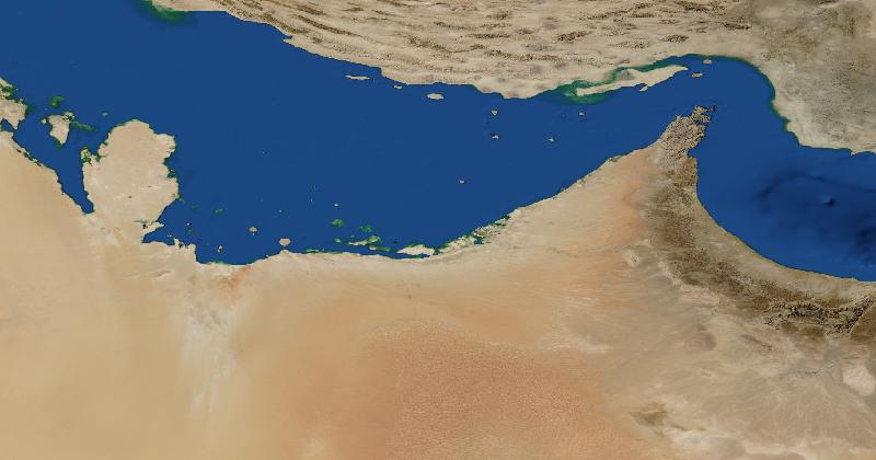
How to Recognise the UAE in Satellite Images
The United Arab Emirates sits along the southern side of the Persian Gulf, with the Hajar Mountains toward the east and desert extending inland.
Read more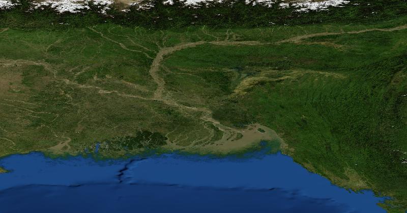
How to Recognise Bangladesh in Satellite Images
The lower Ganges–Brahmaputra–Meghna system is a useful starting point.
Read more
How to Spot a Volcano From Space
Cones, craters, calderas, and dark lava flows give volcanoes away from above. Here is how to recognise a volcano in satellite imagery and where to expect them.
Read more
What Is the Robinson Projection? The Map That Tried to Please Everyone
The Robinson projection was designed to look right rather than be right. Here is how a deliberate compromise became one of the most familiar world maps of the 20th century.
Read more
The Longest Mountain Ranges in the World, Ranked
The longest mountain range on Earth is one almost nobody has seen. Here are the planet’s great ranges ranked by length, from the Andes to a 65,000-kilometre seam on the ocean floor.
Read more
The Driest Places on Earth
Some places have not seen meaningful rain in living memory — and one valley may not have seen any in two million years. A tour of the driest spots on the planet.
Read more
Why Are Farm Fields Perfect Circles From Space?
Those giant green circles scattered across deserts and plains are not a mystery — they are one machine, drawing the same shape millions of times over. Here is the story of center-pivot irrigation.
Read more
What Are the Poles of Inaccessibility? The Hardest Places to Reach on Earth
Point Nemo is so far from land that the nearest humans are sometimes the astronauts overhead. Meet the poles of inaccessibility — the spots on Earth that are as far from the coast as it is possible to get.
Read more
What Is a Great Circle Route? Why Planes Fly Over the Arctic
The shortest path between two cities often looks like a strange curve on a flat map. Great circle routes explain why your flight to Asia heads up toward the pole.
Read more
Why Are Some Countries So Long and Thin?
Chile stretches more than 4,000 kilometres but averages under 200 wide. Why do some countries end up as long ribbons? Mountains, rivers, and history all play a part.
Read more
The Countries That Sit on Two Continents
A handful of countries straddle the line between two continents, from Istanbul's two halves to Russia's vast Europe-to-Asia sprawl. Here is where the borders fall.
Read more
How to Tell Which Hemisphere You're In From the Sky and the Landscape
Drop into an unfamiliar place with no signs to read, which half of the planet are you on? The sun, the stars, and even satellite dishes give it away.
Read more
The Seven Summits: The Highest Mountain on Every Continent
Everest is the tallest mountain on Earth, but every continent has its own high point. Here are the Seven Summits, why climbers chase them, and the one peak that still starts arguments.
Read more
The Longest Coastlines in the World, Ranked
Canada has more coastline than the next several countries combined, but measuring a coast is trickier than it sounds. Here are the longest coastlines on Earth and the strange reason no two sources agree.
Read more
The Highest Capital Cities in the World
Some national capitals sit higher than most ski resorts. Here are the highest capital cities on Earth, why people built there, and what life is like when the air is thin.
Read more
What Is the Winkel Tripel Projection? The Compromise Map on Your Classroom Wall
It is probably the world map you grew up looking at, even if you never knew its name. Here is how the Winkel Tripel projection works and why it became the gold standard for world maps.
Read more
City Lights From Space: What Earth at Night Reveals
The night side of Earth is a glowing map of where people live, how they live, and even where they do not. Here is what satellites see when the Sun goes down.
Read more
How to Identify a Country by Its License Plates
License plates are one of the most reliable clues for figuring out where in the world you are. Here is how their colors, codes, and shapes give away the country at a glance.
Read more
What Is a Fjord? How These Dramatic Coastlines Form
Steep walls, deep water, and a winding path inland: fjords are among the most striking coastlines on Earth. Here is how glaciers carved them and where to find the best ones.
Read more
The Largest Countries in the World by Area, Ranked
From Russia's sprawling landmass to Algeria's Saharan reach, here are the ten biggest countries on Earth by area — and what makes each one so vast.
Read more
The Most Populous Countries: A Dated Comparison
Use one population dataset and reference year before comparing national totals.
Read more
What Is the Gall-Peters Projection? The Map That Started a Fight
The Gall-Peters projection shows every country at its true relative size — and in doing so it sparked one of the longest-running arguments in cartography.
Read more
Can You Really See the Great Wall of China From Space?
It's one of the most repeated 'facts' in the world — and it's mostly a myth. Here's what astronauts can actually see of the Great Wall from orbit.
Read more
What Is the Ring of Fire? Earth's Most Volcanic Region, Explained
A horseshoe of volcanoes and earthquakes wraps around the Pacific Ocean. Here's what the Ring of Fire is, why it exists, and how to spot it on a map.
Read more
Reading the Meta: How Pros Use Bollards, Road Lines, and Signs to Find Any Location
Top location guessers barely look at the scenery. Here's how the 'meta' — bollards, road markings, signs, and small details — gives away a country in seconds.
Read more
Why Are Deserts Where They Are? The Geography of the World's Dry Belts
Deserts aren't random. Most sit along predictable latitude bands shaped by global air circulation, mountains, and cold ocean currents. Here's the geography behind the world's driest places.
Read more
What Are Antipodes? The Point on the Exact Opposite Side of Earth
If you dug straight down through the centre of the Earth, where would you come out? Almost certainly the ocean. Here's what antipodes are and why 'digging to China' is mostly a myth.
Read more
What Causes the Seasons? The Geography of Earth's Tilt
It's a common myth that summer happens when Earth is closest to the Sun. The real reason is the planet's tilt, and it explains everything from long summer evenings to the polar night.
Read more
Why Is the Ocean Different Colors? Reading Sea Color From Space
From deep navy to turquoise to muddy brown, the sea is never just 'blue.' Here's what ocean colour reveals about depth, currents, and life, and how to read it from satellite imagery.
Read more
The Geography of River Deltas: How Rivers Build Land at the Sea
Where rivers meet the sea they drop their sediment and build new land: fans, fingers, and arcs of fertile ground. Here's how deltas form, the shapes they take, and how to spot them from above.
Read more
What Is a Watershed? How to See River Basins From Space
Every drop of rain that falls eventually flows somewhere. A watershed is the area of land that funnels water into one river, and the boundaries between them shape borders, cities, and conflicts.
Read more
How to Tell Ice Caps, Glaciers, and Sea Ice Apart From Space
Not all ice is the same. Glaciers, ice sheets, and sea ice form differently and look different from orbit. Here's a field guide to reading the planet's frozen places from satellite imagery.
Read more
The Most Isolated Inhabited Places on Earth
Some communities live thousands of kilometers from the nearest town — on volcanic specks in the open ocean, deep in canyons, or in the coldest corners of Siberia. Here are the most remote places people actually call home.
Read more
Natural Wonders You Can See From Space
From the turquoise of the Bahama Banks to the bullseye of the Sahara, these are the natural features so vast they are unmistakable from orbit — and what they teach you about reading satellite imagery.
Read more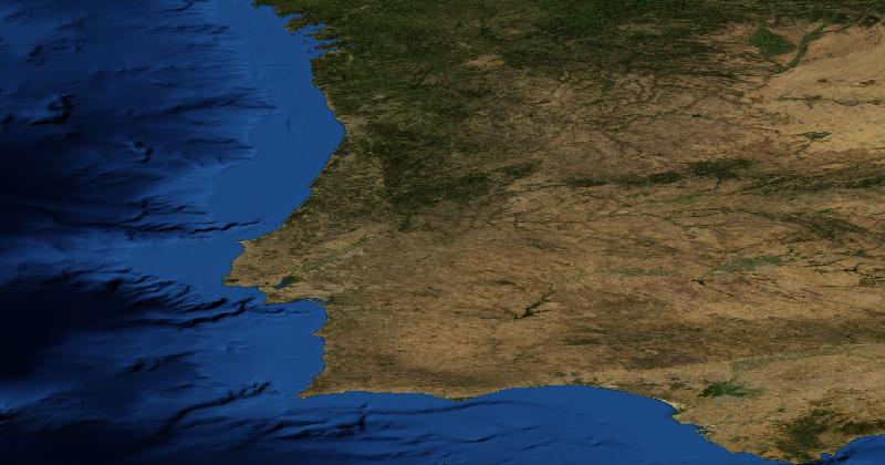
How to Recognise Portugal in Satellite Images
Mainland Portugal occupies the Atlantic side of Iberia.
Read more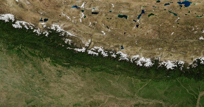
How to Recognise Nepal in Satellite Images
Nepal lies along the southern Himalaya.
Read more
Why Are Some Borders Perfectly Straight?
Rivers and mountains make wiggly borders. So why do so many run dead straight across deserts, plains, and even cities? The answer is part geometry, part history, and part colonial map-drawing.
Read more
The Countries That Changed Their Names (And Why)
Türkiye, Eswatini, Czechia, North Macedonia, Myanmar — plenty of countries have changed what they call themselves. The reasons range from shedding colonial baggage to settling decades-long disputes.
Read more
The Equal Earth Projection: Comparing Areas on a World Map
An equal-area projection designed for world maps, with its own shape and distance trade-offs.
Read moreWhat Human-Made Structures Can You Actually See From Space?
The Great Wall of China is the famous answer — and it is wrong. Here is what humans have actually built that stands out from orbit.
Read more
Why Do Some Countries Drive on the Left?
About a third of the world drives on the left. The reasons go back to swords, freight wagons, the British Empire, and one dramatic morning in Sweden.
Read more
How to Read Shadows in Satellite Imagery (And What They Reveal)
Shadows are not noise in a satellite image — they are data. They can tell you the height of a building, the time of day, and even which hemisphere you are looking at.
Read more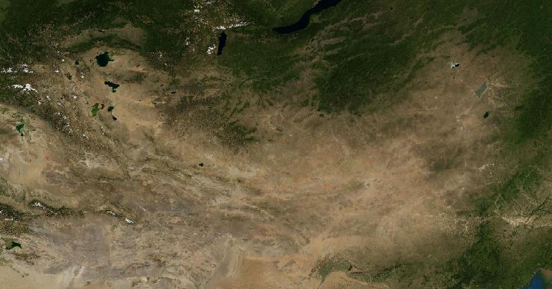
How to Recognise Mongolia in Satellite Images
A broad regional view shows open steppe grading into the drier Gobi in the south, with mountain ranges in the west and forested areas in the north.
Read more
What Is a Landlocked Country? The 44 Nations With No Coastline
Forty-four countries have no access to the sea — and two are surrounded entirely by other landlocked countries. Here is what that means for trade, maps, and one very specific kind of trivia.
Read more
The Largest Waterfalls in the World, Ranked by Volume (Not Height)
The tallest waterfalls barely move any water. Here are the planet's true heavyweights — the wide, thundering cataracts that push the most water over the edge every second.
Read more
The Most Populous Cities: Why the Definition Matters
Jakarta leads the UN’s 2025 comparison; city boundaries explain why older lists look different.
Read more
The Deepest Places on Earth: Trenches, Caves, Mines, and One Very Deep Hole
From the bottom of the Mariana Trench to a Soviet borehole that unsettled its own scientists, here are the deepest points humans have found — and the few we've actually reached.
Read more
Why Is North Always Up on Maps? It Wasn't Always
There's no physical reason north belongs at the top of a map. The convention is younger than you'd think — and for most of history, maps pointed somewhere else entirely.
Read more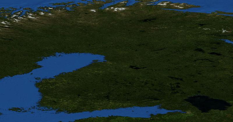
How to Recognise Finland in Satellite Images
Southern and central Finland contain extensive mosaics of forest and lakes.
Read more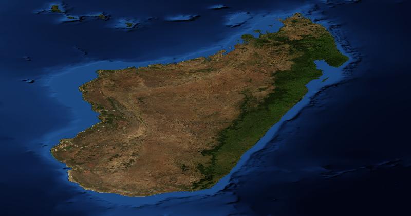
How to Recognise Madagascar in Satellite Images
Madagascar is a long island east of Mozambique, separated from the mainland by the Mozambique Channel.
Read moreBeyond Mercator: 6 Map Projections and What Each One Distorts
Every flat map lies about something — area, shape, distance, or direction. Here are six map projections beyond Mercator, what each one preserves, what it sacrifices, and when to use it.
Read more
The 10 Largest Lakes in the World, Ranked (And Why the Caspian Is Really a Lake)
From an inland sea bigger than Germany to the Great Lakes of North America, here are the 10 largest lakes on Earth by surface area — plus the surprisingly tricky question of what counts as a lake.
Read more
The 10 Highest Mountains in the World, Ranked (And Why Everest Isn't the Tallest)
All ten of the world's highest peaks are in the Himalaya and Karakoram, and every one clears 8,000 metres. Here they are ranked by elevation — plus why 'highest' and 'tallest' are two different contests Everest doesn't both win.
Read more
How Do Time Zones Work? The Geography Behind the Clock
Why is it tomorrow in Tokyo when it's still today in New York? Here's how time zones map onto the planet, why some are offset by 30 or 45 minutes, and where a single day begins and ends.
Read more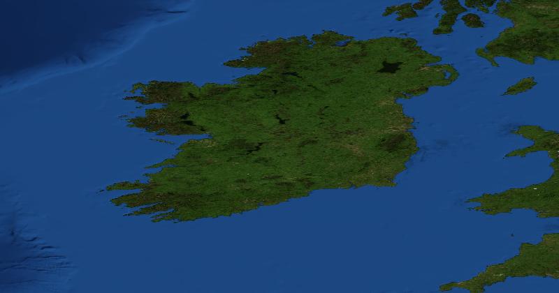
How to Recognise Ireland in Satellite Images
The island of Ireland has deeply indented stretches of Atlantic coastline, particularly in the west and southwest.
Read more
World Capitals Quiz: How to Actually Learn All 195 Capital Cities
Memorising every capital city in the world sounds impossible. It is not. With the right grouping, the right tricks, and a daily two-minute habit, almost anyone can get to 195 in three months.
Read more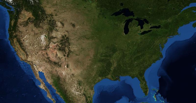
How to Recognise the United States in Satellite Images
The contiguous United States includes the western Cordillera, broad interior plains, and the Appalachian belt in the east.
Read more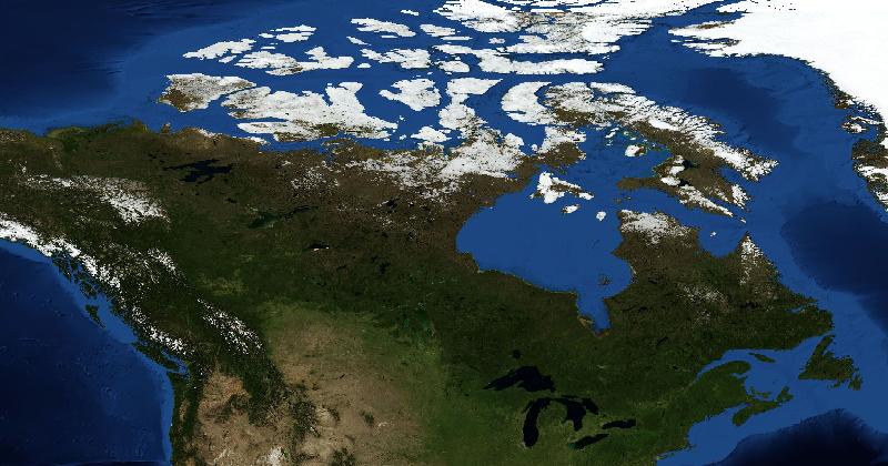
How to Recognise Canada in Satellite Images
Southern central Canada contains broad agricultural plains, while much of the Canadian Shield is a mixture of exposed rock, forest, and lakes.
Read more
Strangest Borders in the World: 12 Geopolitical Curiosities That Sound Made Up
Most country borders are tidy, boring lines. A few are absolute chaos — enclaves inside enclaves, islands four kilometres apart in different days, land claimed by no one at all. Here are twelve of the strangest.
Read more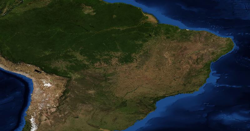
How to Recognise Brazil in Satellite Images
The Amazon crosses northern Brazil through an extensive lowland forest region.
Read more
Worldle vs Globle vs Travle: Daily Geography Games Compared
The Wordle craze produced a whole subgenre of daily geography puzzles. Worldle, Globle, and Travle each take a different approach to the same two-minute habit. Here is how they compare, and which one fits you best.
Read more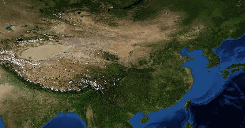
How to Recognise China in Satellite Images
China includes the Tibetan Plateau in the southwest, dry inland basins farther north, and extensive settled plains in the east.
Read more
GeoGuessr Alternatives: Which Format Do You Want?
Compare the activity before changing games: street scenes, walking videos, satellite images, and map puzzles reward different observations.
Read more
The 10 Smallest Countries in the World (And What Life Is Like There)
Some countries are smaller than your nearest airport. From Vatican City at half a square kilometre to Malta at 316, here are the world's ten smallest sovereign states — and the strange lives people lead inside them.
Read more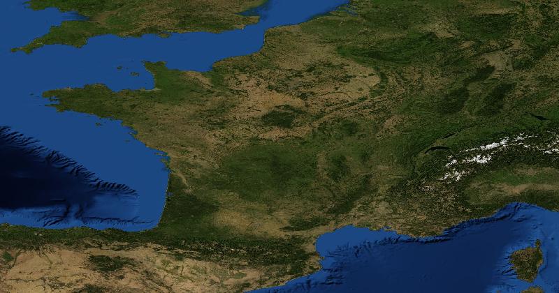
How to Recognise France in Satellite Images
In metropolitan France, the Alps mark the southeast and the Pyrenees the southwest.
Read more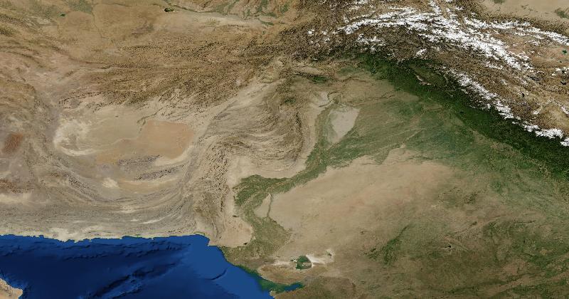
How to Recognise Pakistan in Satellite Images
The Indus system connects the northern mountains with the irrigated plains and the Arabian Sea.
Read more
The 10 Largest Deserts in the World, Ranked (And Yes, Antarctica Counts)
Most people think the Sahara is the largest desert in the world. It is not even close. The actual ranking surprises almost everyone — and reveals what the word "desert" really means.
Read more
Guess Where You Are: The Best Online Games for Finding Mystery Locations
There is a whole genre of online games built around one question: guess where you are. Here is how the different formats work, what skill each one trains, and which is right for you.
Read more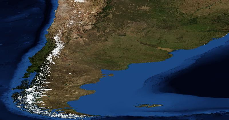
How to Recognise Argentina in Satellite Images
East of the Andes, the Pampas form a broad lowland around the Río de la Plata.
Read more
How to Compare an AI and Human Players on Satellite Imagery
A fair satellite-location comparison needs the same images, fixed rules, and a published result for every guess. Here is how to set one up.
Read moreMapping Games With Different Kinds of Clues
Five formats to compare, without unsupported claims about growth or popularity.
Read more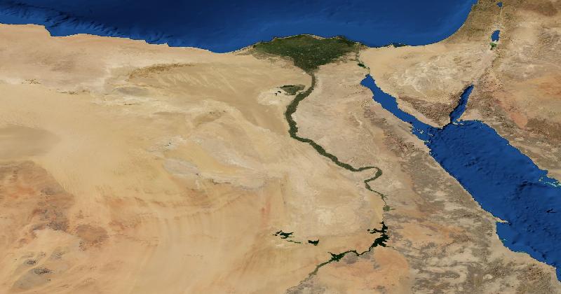
How to Recognise Egypt in Satellite Images
The Nile forms a narrow cultivated corridor through arid land before widening into a delta at the Mediterranean coast.
Read moreWhat Is a Satellite Guesser? Inside the Geography Game Category Quietly Taking Off
The street-view guesser had its moment. Now a different style of geography game is finding its audience — one where you read the planet from above instead of standing on its roads. Here is what a satellite guesser actually is.
Read more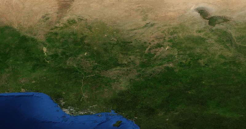
How to Recognise Nigeria in Satellite Images
The Niger Delta is a useful coastal anchor, with distributary channels entering the Gulf of Guinea.
Read more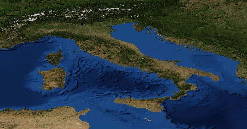
How to Recognise Italy in Satellite Images
Northern Italy contains the broad Po plain below the Alps.
Read more
Country Shape Quiz: How to Recognize Every Country From Its Outline
Most adults can name countries on a labelled map and immediately fail when you show them the same countries with the labels removed. The good news is that country-shape recognition is one of the most learnable skills in geography. Here is how to build it.
Read more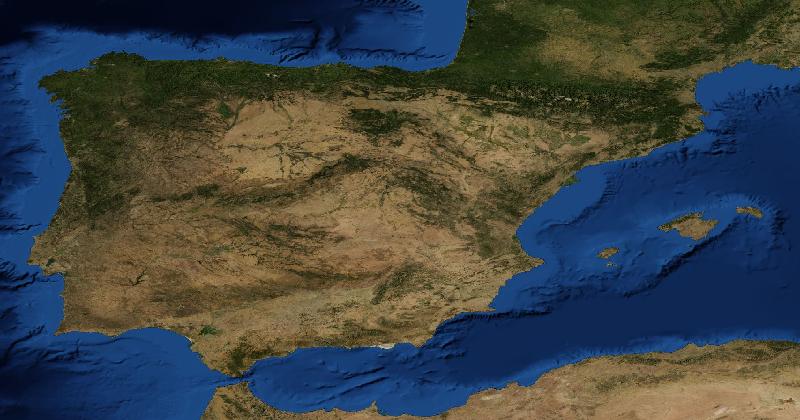
How to Recognise Spain in Satellite Images
Mainland Spain includes a broad interior plateau, the Pyrenees in the northeast, and several other mountain belts.
Read more
Will AI Replace Geography Games? Probably the Opposite
AI can already identify many locations from a single image. So why has the audience for geography games grown faster than ever in the AI era? Because the games were never really about finding the right answer.
Read more
The 10 Largest Islands in the World, Ranked (And Why Australia Doesn't Count)
Greenland is the largest island on Earth — and the gap between first and second place is enormous. Here are the ten largest islands ranked by area, with the geography, geology, and surprises behind each one.
Read more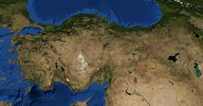
How to Recognise Turkey in Satellite Images
Much of Turkey occupies the Anatolian Peninsula.
Read moreThe Hardest Places on Earth to Identify From Satellite Imagery
Some satellite views are almost impossible to place — featureless deserts, identical-looking taiga, anonymous coastlines, open ocean. Here is what makes these images so hard, and the strategies that experienced players use to crack them.
Read more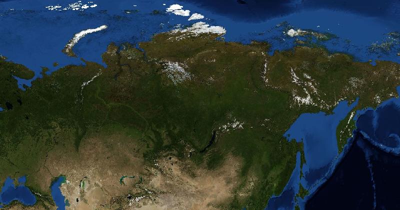
How to Recognise Russia in Satellite Images
Russia spans forest, steppe, tundra, and high mountain regions.
Read more
How Many Countries Can You Name in 5 Minutes?
Try a timed country quiz, then use your missing answers to choose what to practise. Set consistent rules before comparing scores.
Read more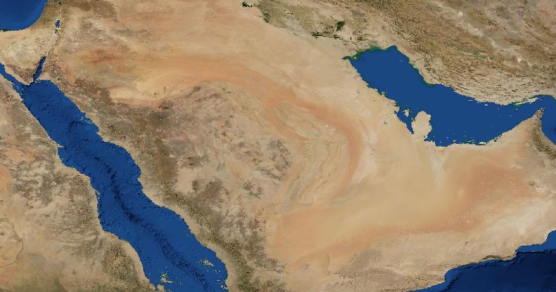
How to Recognise Saudi Arabia in Satellite Images
Saudi Arabia has a long Red Sea coast, elevated terrain in the west, and broad dry interior regions.
Read moreThe 10 Longest Rivers in the World, Ranked (The Top Spot Is Closer Than You Think)
Is the Nile longer than the Amazon, or the other way around? The answer is more contested than most people realise. Here are the ten longest rivers on Earth, ranked, with the geography, hydrology, and ongoing debates behind each.
Read moreWhy Location-Guessing Games Are Satisfying
How clues, location reveals, and shared rounds give players something to investigate.
Read more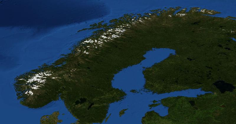
How to Recognise Norway in Satellite Images
Mainland Norway has a long, indented Atlantic coast backed by mountain terrain.
Read moreIs Geography the New Chess? The Parallels Are Closer Than You Think
Online chess exploded between 2020 and 2024. Online geography is following the same trajectory. Here are the structural similarities, the differences, and an honest assessment of where this category might go.
Read more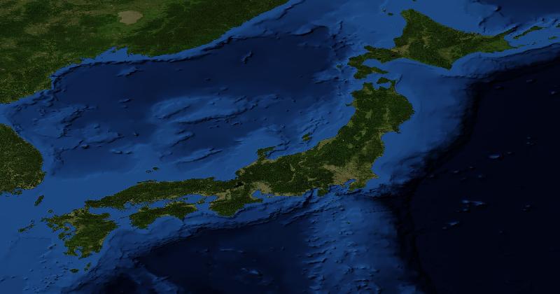
How to Recognise Japan in Satellite Images
Japan has mountainous islands with much of the dense urban development on coastal plains and in valleys.
Read more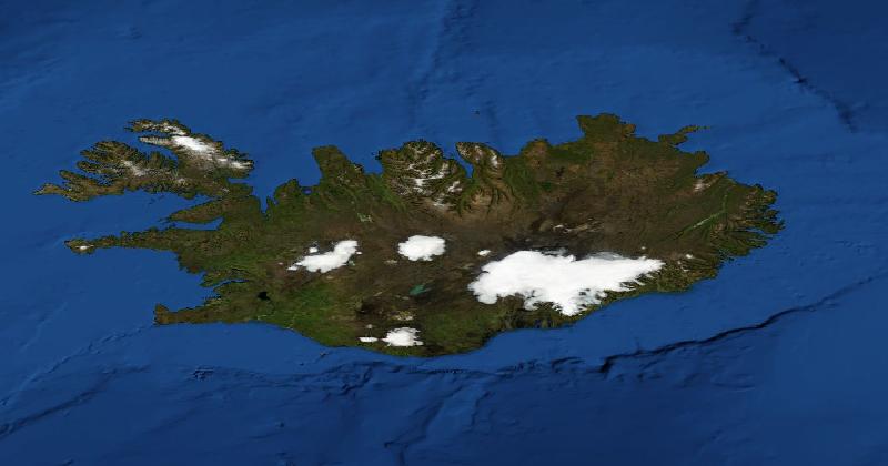
How to Recognise Iceland in Satellite Images
Iceland combines broad ice caps, sparsely vegetated interior terrain, and a deeply indented coastline in the northwest and east.
Read more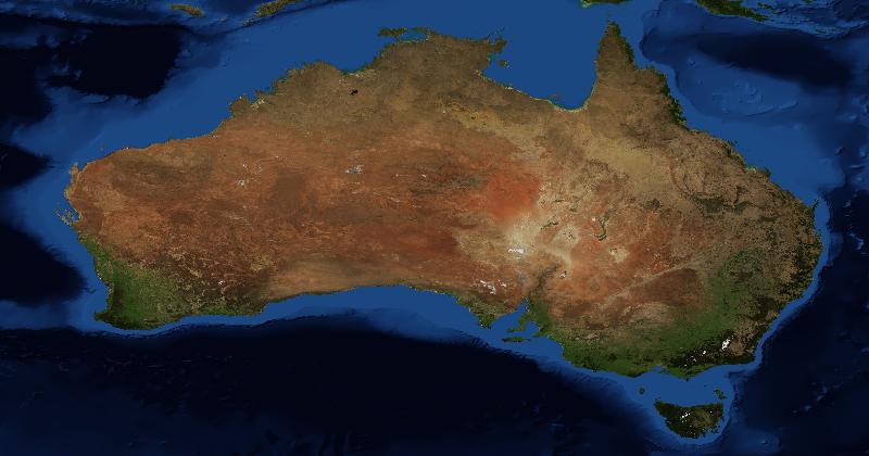
How to Recognise Australia in Satellite Images
The arid interior occupies much of a wide view of Australia.
Read moreHow Many Oceans Are There? The Five-Ocean Debate, Settled
Some textbooks list four oceans, others five, and a few persist with seven. So how many oceans are there really, and which answer is the right one in 2026? Here's a clear explainer of the debate, the geography, and what changed in 2021.
Read more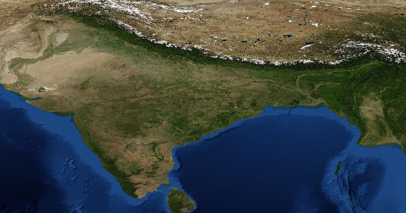
How to Recognise India in Satellite Images
The Himalayas border the north, with the broad Indo-Gangetic Plain below them.
Read more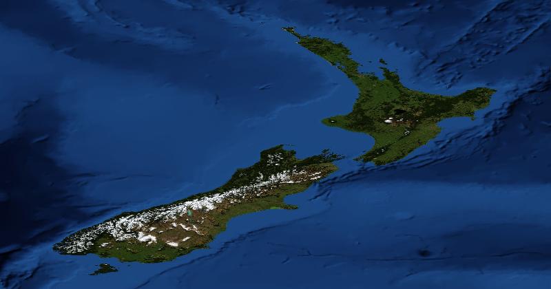
How to Recognise New Zealand in Satellite Images
The Southern Alps run along much of the South Island, with broad plains to the east and a wetter, more dissected western side.
Read more
Why Is Russia So Big? The Geographic and Historical Reasons
Russia is the largest country on Earth by a margin that does not feel intuitive. Here is the combination of geography, history, and political choice that produced it.
Read more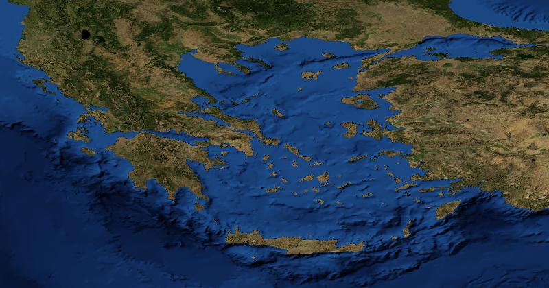
How to Recognise Greece in Satellite Images
Greece has a deeply indented mainland coast and many islands in the Aegean and Ionian seas.
Read more10 Country Flags You Always Mix Up (And How to Tell Them Apart)
Some country flags are nearly identical at first glance. Here are the ten pairs people most often confuse — and the small details that distinguish them.
Read moreWhy Is Greenland Called Greenland?
The name comes from a Norse settlement story, not a description of the whole island.
Read more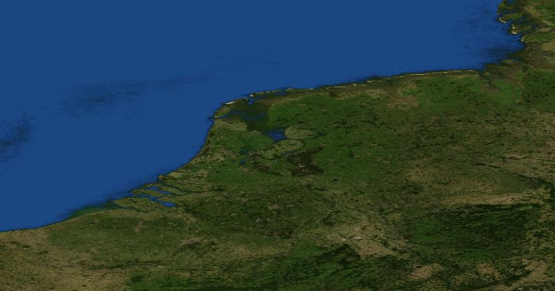
How to Recognise the Netherlands in Satellite Images
The Rhine-Meuse delta, IJsselmeer, and North Sea coast help orient a regional view of the Netherlands.
Read more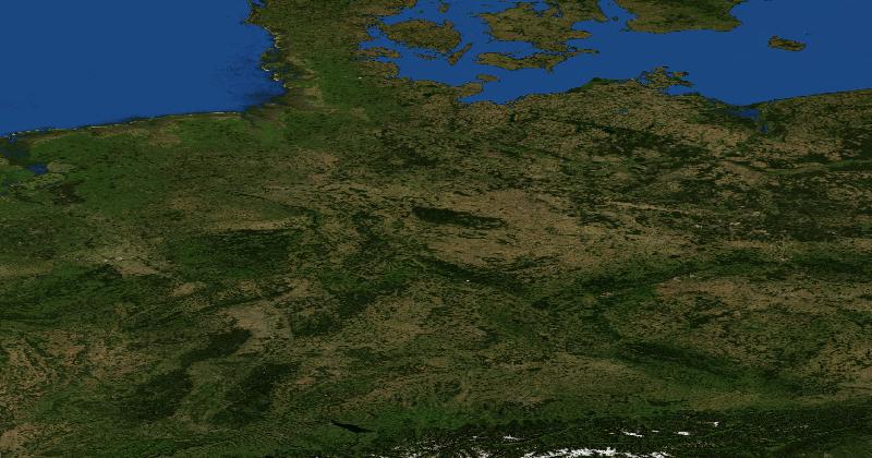
How to Recognise Germany in Satellite Images
Northern Germany belongs to a lowland region bordering the North and Baltic seas.
Read more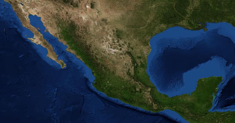
How to Recognise Mexico in Satellite Images
The Baja California peninsula lies across a narrow gulf from mainland Mexico.
Read more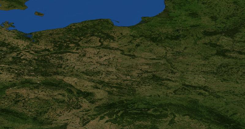
How to Recognise Poland in Satellite Images
Poland has a Baltic coast in the north, extensive inland plains, and mountain terrain along parts of the southern border.
Read more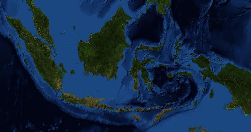
How to Recognise Indonesia in Satellite Images
Indonesia spans a long island chain between the Indian and Pacific oceans.
Read more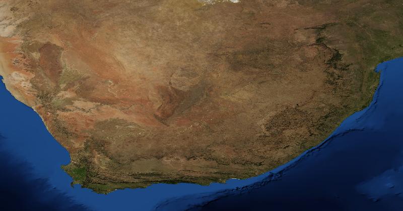
How to Recognise South Africa in Satellite Images
South Africa contains a broad interior plateau with escarpments near parts of the eastern and southern margins.
Read more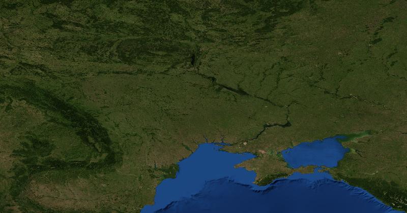
How to Recognise Ukraine in Satellite Images
Much of Ukraine consists of plains and agricultural land, while the Carpathians enter the west.
Read more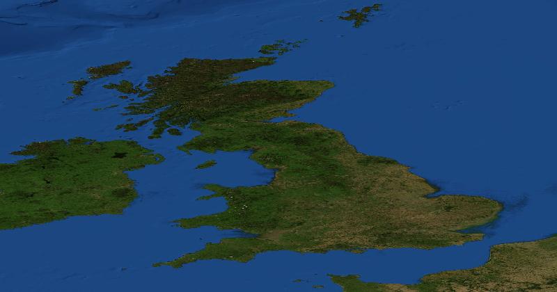
How to Recognise the United Kingdom in Satellite Images
Great Britain has rugged uplands in Scotland and Wales, with broader lowlands across much of southern and eastern England.
Read more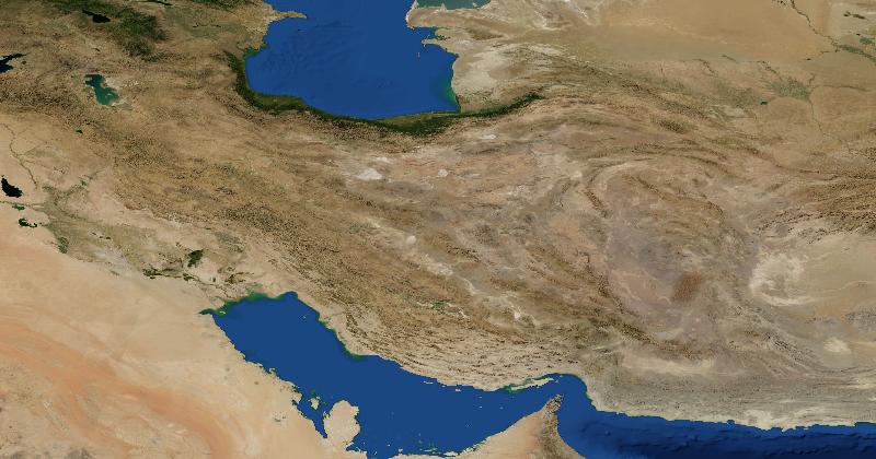
How to Recognise Iran in Satellite Images
The Zagros form a belt of ridges across western and southwestern Iran.
Read more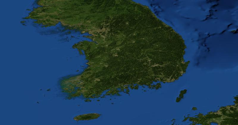
How to Recognise South Korea in Satellite Images
South Korea occupies the southern part of the Korean Peninsula.
Read more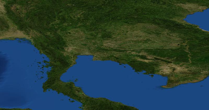
How to Recognise Thailand in Satellite Images
Thailand has a broad central lowland around the Chao Phraya, higher terrain in the north, and the Khorat Plateau in the northeast.
Read moreWhy Are There So Many Countries in Europe? A Geographic and Historical Explainer
Europe is roughly the size of the United States but contains 44 countries — about ten times as many. Here's the combination of geography, history, and politics that produced one of the most fragmented continents on Earth.
Read more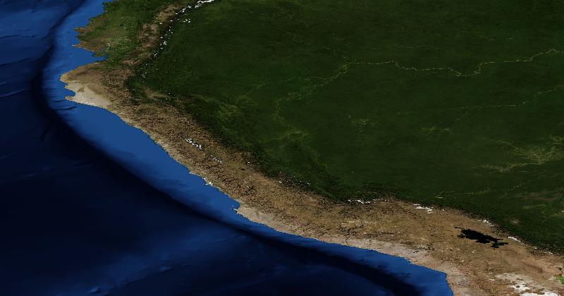
How to Recognise Peru in Satellite Images
Peru has a dry Pacific coastal strip, high Andean terrain inland, and Amazon lowlands to the east.
Read more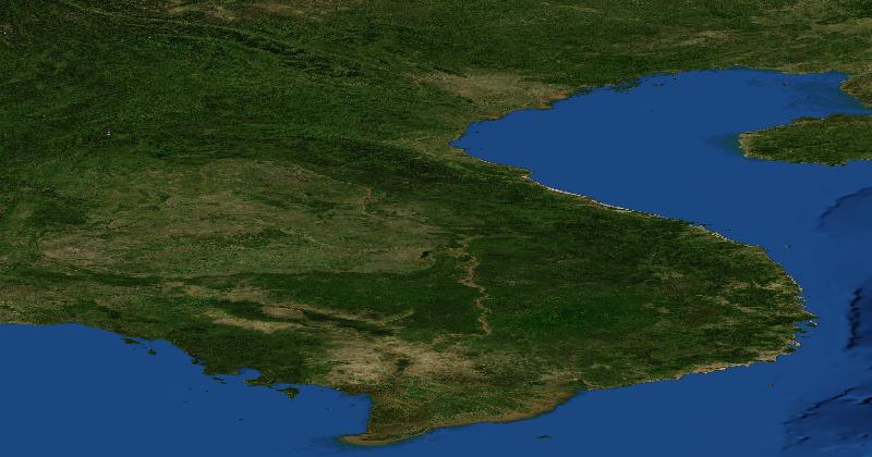
How to Recognise Vietnam in Satellite Images
Vietnam has the Red River delta in the north, the Mekong delta in the south, and a narrower central coastal region backed by mountains.
Read more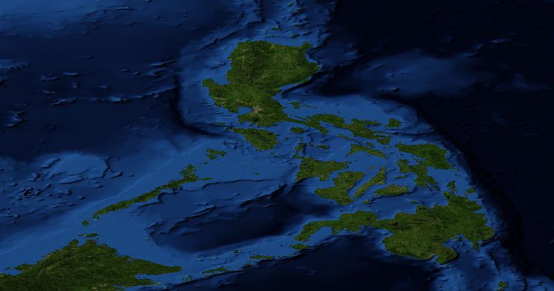
How to Recognise the Philippines in Satellite Images
The Philippines consists of islands with varied coastlines and mountainous interiors.
Read more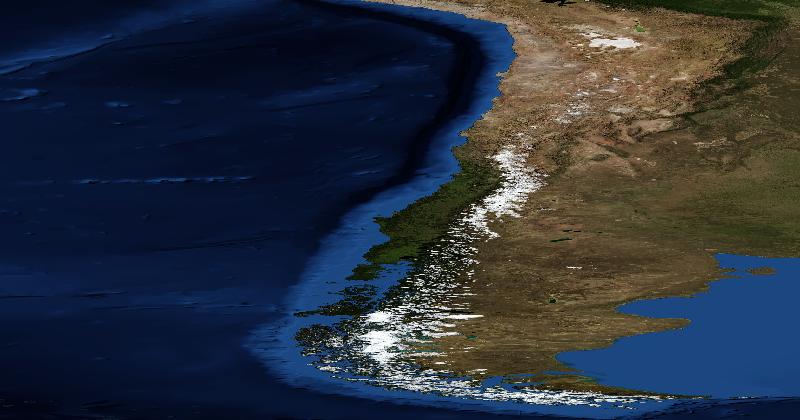
How to Recognise Chile in Satellite Images
Chile follows the Pacific side of the Andes.
Read more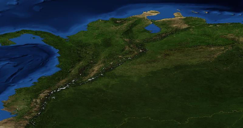
How to Recognise Colombia in Satellite Images
Western Colombia has several Andean ranges separated by valleys.
Read more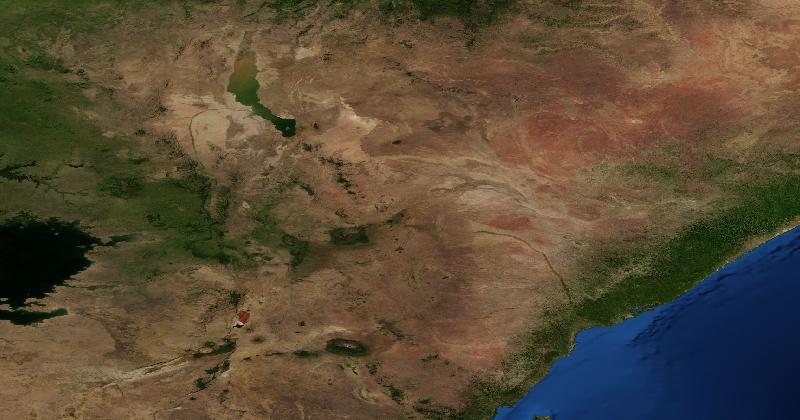
How to Recognise Kenya in Satellite Images
Kenya includes central highlands, Rift Valley lakes, dry northern and eastern lowlands, and an Indian Ocean coast.
Read more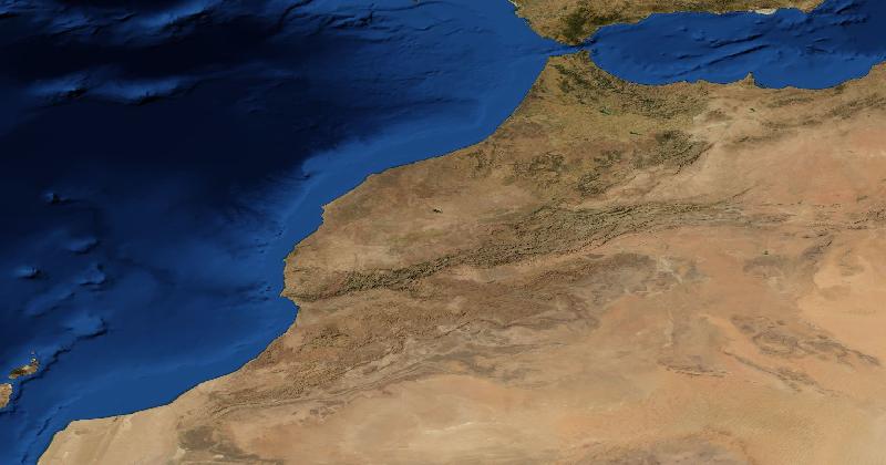
How to Recognise Morocco in Satellite Images
The Atlas Mountains run across Morocco, separating parts of the Atlantic-facing lowlands from drier interior terrain.
Read more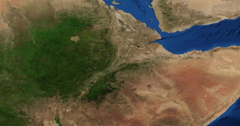
How to Recognise Ethiopia in Satellite Images
The Ethiopian Highlands form elevated terrain beside much lower, drier land in the northeast.
Read more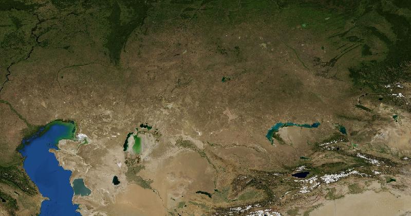
How to Recognise Kazakhstan in Satellite Images
Much of Kazakhstan is open lowland or steppe, with drier country towards the south and mountains in the east and southeast.
Read more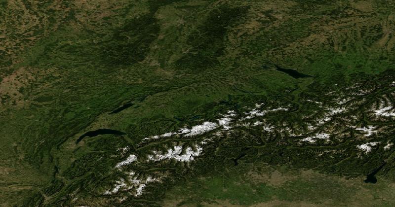
How to Recognise Switzerland in Satellite Images
The Swiss Alps occupy much of the south and centre.
Read moreThe Mercator Projection: Useful Bearings, Distorted Areas
Mercator preserves local angles, but enlarges high latitudes. Choose a projection for the comparison you need.
Read more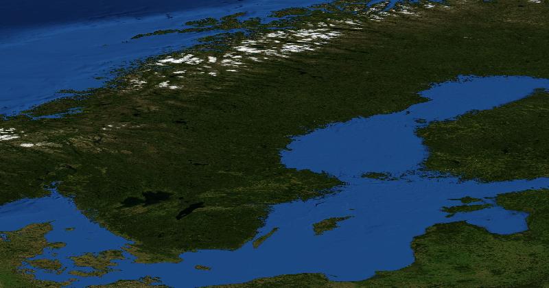
How to Recognise Sweden in Satellite Images
Sweden has a long Baltic coastline and a largely forested interior, with more extensive agriculture in the south.
Read more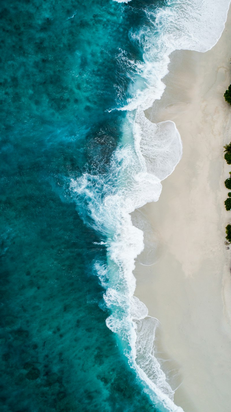
The World's Most Remote Places You've Never Heard Of
True remoteness is rarer than you think — and the places that qualify are extraordinary. Here are some of Earth's most isolated corners, and what makes them so hard to reach.
Read more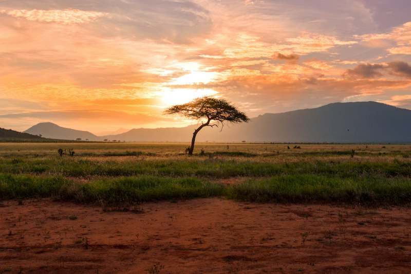
How to Compare Africa’s Size Without a Misleading Map
Area, travel distance, and landscape variety answer different questions about the continent.
Read moreThe Most Recognizable Places on Earth From Satellite View
Some places on Earth are so distinctive from above that even a glimpse of satellite imagery is enough to place them instantly. Here are the world's most recognizable landscapes as seen from space.
Read more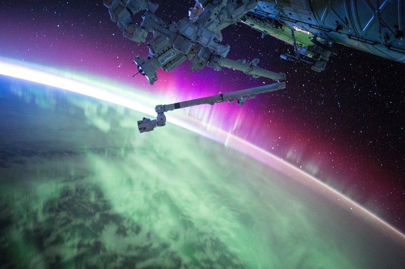
How to Read a Satellite Image: A First Pass
Start with scale and orientation, then separate observations from guesses.
Read more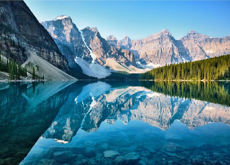
Reading Land Use From Above
Visible cover can suggest a use, but it rarely proves ownership, crop type, or activity.
Read more15 Geography Facts That Will Change How You See the World
From continents that aren't where you think to countries that are larger than you imagined, these geography facts upend the mental map most people carry around.
Read moreThe Art of Reading Terrain From Above
River deltas, mountain ridges, and agricultural patterns — how strong players decode satellite imagery layer by layer to pinpoint a location.
Read more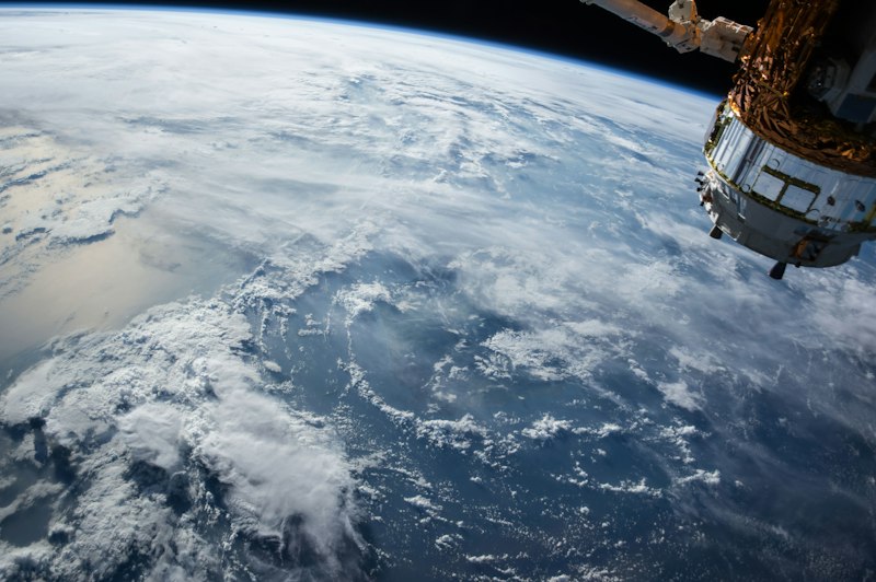
How Satellite Imagery Became a Record of Change
Weather observations, reconnaissance, and land monitoring developed different ways to observe Earth.
Read more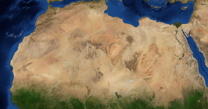
What the Sahara Desert Looks Like From Space
The Sahara is larger than the contiguous United States — and from orbit, it is one of the most dramatic and varied landscapes on Earth. Here is what you actually see.
Read moreWhat Is GIS and Why Should You Care?
Geographic Information Systems power everything from emergency response to climate modeling to the apps on your phone. Here's what GIS actually is, how it works, and why it matters.
Read more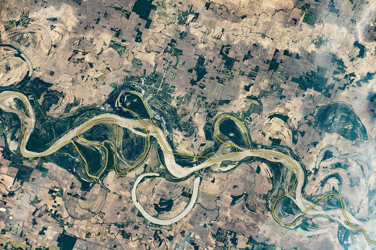
Why Rivers Meander, With an Example From the Mississippi
River bends migrate as banks erode and sediment accumulates. Old channels can remain visible beside the active river.
Read moreA Geography Game Night for a GIS Team
Take turns explaining an unfamiliar satellite image. A suggested format for a GIS team, with room to compare specialist knowledge and mistaken guesses.
Read more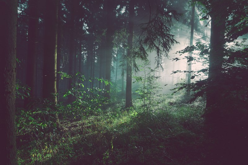
Understanding Earth's Biomes Through Satellite Imagery
From tropical rainforests to Arctic tundra, Earth's biomes are written in color and texture across the planet's surface. Here's how to read them from above.
Read moreHow Well Do You Really Know Earth's Surface? A Satellite Literacy Challenge
GIS professionals work with satellite imagery every day — but how well can you actually read the land from above? Test your satellite literacy with this challenge designed for geospatial professionals.
Read more10 Mind-Blowing Things You Can See From Space
The Great Wall of China is not one of them — but what you can actually see from orbit will surprise you far more. Here are ten real, verified things visible from space that will change how you look at our planet.
Read more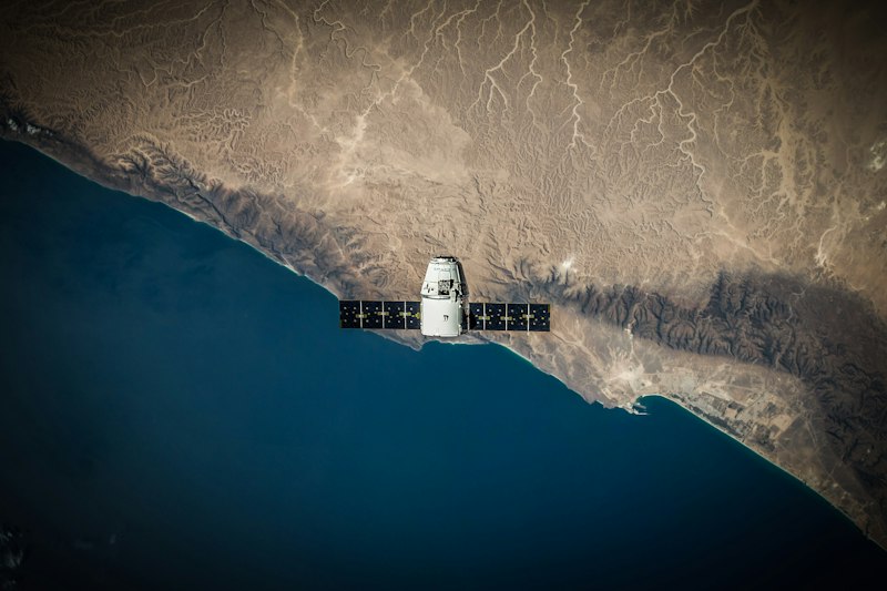
What Satellite Archives Add to Geography Lessons
Use dated images to ask how a place changed, then check other explanations.
Read more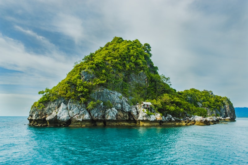
The Geography of Coastlines: Patterns and Clues
Fjords, mangroves, barrier islands, rias, deltas, and coral atolls — a field guide to the world's coastlines and how to identify them from above.
Read more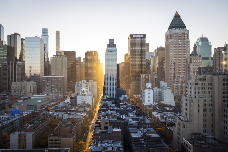
Urban vs Rural: What Makes a Location Hard?
Cities give you a hundred clues at once. The middle of a forest in central Russia gives you almost nothing. Why rural frames are systematically harder than urban ones — and how strong players close the gap.
Read more