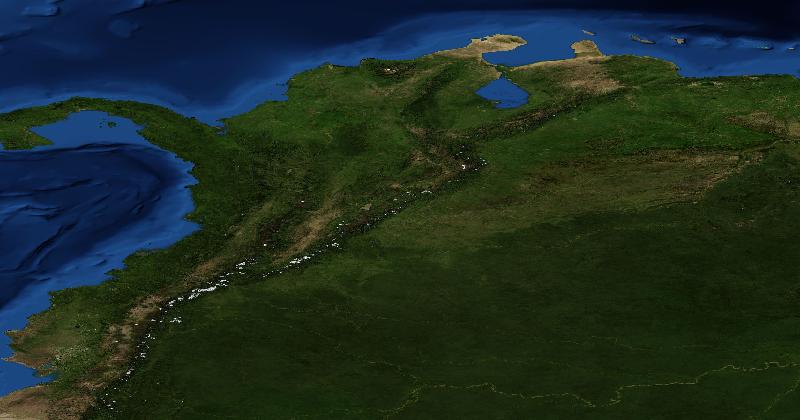
Show EarthGuessr players a satellite view of the Colombian rainforest and almost one in five will put their pin in Brazil. For Peru the figure is 20%, for Bolivia 18%. We looked at 20,940 guesses from 5,404 mixed-country games, played between 20 March and 9 November 2026, to see which places players recognise from space and which ones they keep mistaking for somewhere else.
How we measured it
In each EarthGuessr round a player sees a satellite view of a location and drops a pin on a world map. We record the distance between the pin and the answer. We kept only games whose rounds covered at least three different countries, so the player had no hint about which country to expect. Single-country games would make France or Japan look far easier than they are.
The database stores where a pin landed but not which country that is, so we assigned each guess to a country using a one-degree grid built from our own tagged locations. About one guess in five (4,470 of 20,940) landed in the ocean or in a cell we could not assign, and those are left out of the country percentages below. Distances use every guess.
Across all of them, the median guess was 534 km from the answer. 28% of guesses landed within 100 km, 19% were more than 5,000 km off, and 12% landed in the wrong hemisphere.
Every rainforest is Brazil
Rainforest canopy looks much the same from orbit whether it grows in the Amazon, the Congo Basin or Southeast Asia, and players resolve the doubt in one direction. Brazil received 803 guesses but only had 461 locations in these games, 1.74 times its fair share. 479 of those guesses were for locations somewhere else.
- Peru: 20% of guesses landed in Brazil.
- Colombia: 18%.
- Bolivia: 18%.
- Ecuador: 10%.
- DR Congo: 9%, on a different continent.
- Cambodia: 9%.
- Papua New Guinea: 7%.
Pick a country in the chart below to see where players clicked when it was the answer.
The forest itself rarely gives the country away. Edges do: the wall of the Andes on the western side of Peru, Ecuador and Colombia, the Pacific coast, or the Altiplano's dry highlands in Bolivia. Our country guides on spotting Peru and Colombia from satellite imagery walk through those clues.
The magnet countries
Some countries attract guesses far beyond how often they come up. To measure it we divided each country's share of all guesses by its share of the actual locations. A ratio of 1.0 means players guess it exactly as often as it appears.
Germany tops the list at 1.77: 214 guesses landed in Germany for 121 German locations. It is Europe's default answer, collecting 13% of guesses for Polish locations and 9% for Dutch ones. The United States is close behind at 1.58 and collects more wrong guesses than any other country, 560 in total. Players put 13% of Canadian locations in the US, along with 10% of Mexican, 7% of Australian and British, and 6% of South African ones.
At the other end are countries players almost never pick unless they are sure. Belarus, North Korea, Burkina Faso, Czechia and Papua New Guinea all receive roughly half as many guesses as they have locations. Russia and Canada, despite their size, come out close to even.
The southern hemisphere gets pulled north
For countries that sit well away from the equator, a guess on the wrong side of it is a big miss. For a typical northern-hemisphere country that happens to about 5% of guesses. For southern-hemisphere countries it is several times higher: 29% for Chile, 28% for Angola, 25% for Argentina and Australia. Australia's most common wrong answer is the United States.
The data shows the pattern but not the cause. One plausible reason is that a desert, a coastline or a mountain range reminds players of a northern-hemisphere example they already know. Sun angle and the direction of shadows are among the few clues in a satellite image that give the hemisphere away; our guide to telling which hemisphere you are in explains how to use them.
Neighbours that blur together
Most confusions happen across a border, where the landscape does not change at the line on the map. These were the strongest pairs among countries with at least 150 guesses:
- Nepal: 26% of guesses landed in India.
- Belarus: only 29% landed in Belarus itself, with 16% in Russia, 14% in Ukraine and 13% in Poland.
- Tajikistan: 16% in Uzbekistan.
- Sudan: 15% in Egypt.
- North Korea: 15% in China and 9% in South Korea.
- Ireland: 14% in the United Kingdom.
- Sweden: 13% in Norway.
- Iraq: 13% in Iran.
- Zimbabwe: 12% in Mozambique and 9% in South Africa.
The easiest and hardest countries to place
Measured by median miss, the Netherlands is the easiest country to place from space at 53 km, followed by Italy (73 km), Sri Lanka (75 km), Japan (104 km), Spain (121 km) and Egypt (140 km). Egypt has the highest share of guesses landing in the right country, 81%, which fits the Nile's narrow green strip through the desert. Papua New Guinea is the hardest at 2,275 km, with 19% of guesses landing in Indonesia. Burkina Faso has the lowest right-country rate: 26%.
Read the two measures together. Median miss favours small countries, because any guess inside them is close to the answer. Right-country rate favours large ones, because a loose guess still lands inside. Russia's median miss of 1,389 km partly reflects its size; 60% of guesses for Russian locations still landed in Russia.
The map shows the same measure at a finer scale. Western Europe, the Nile valley and Japan are pale. The Sahel, Siberia, central Africa, New Guinea and Australia are dark.
Limits of this data
- It is a snapshot of guesses made between 20 March and 9 November 2026. Earlier guesses are not stored.
- Games do not record their mode, so we treated any game covering three or more countries as a mixed-country game.
- The guessed country comes from our own location grid, not from official borders. Guesses near borders and coasts are the most likely to be misassigned or left out.
- Each country has between 150 and 1,310 guesses, so a single percentage can be several points off. Treat small gaps between countries as noise.
- Locations come from the EarthGuessr location pool, not a random sample of the Earth's surface, and the players chose to play. The results describe EarthGuessr players, not people in general.